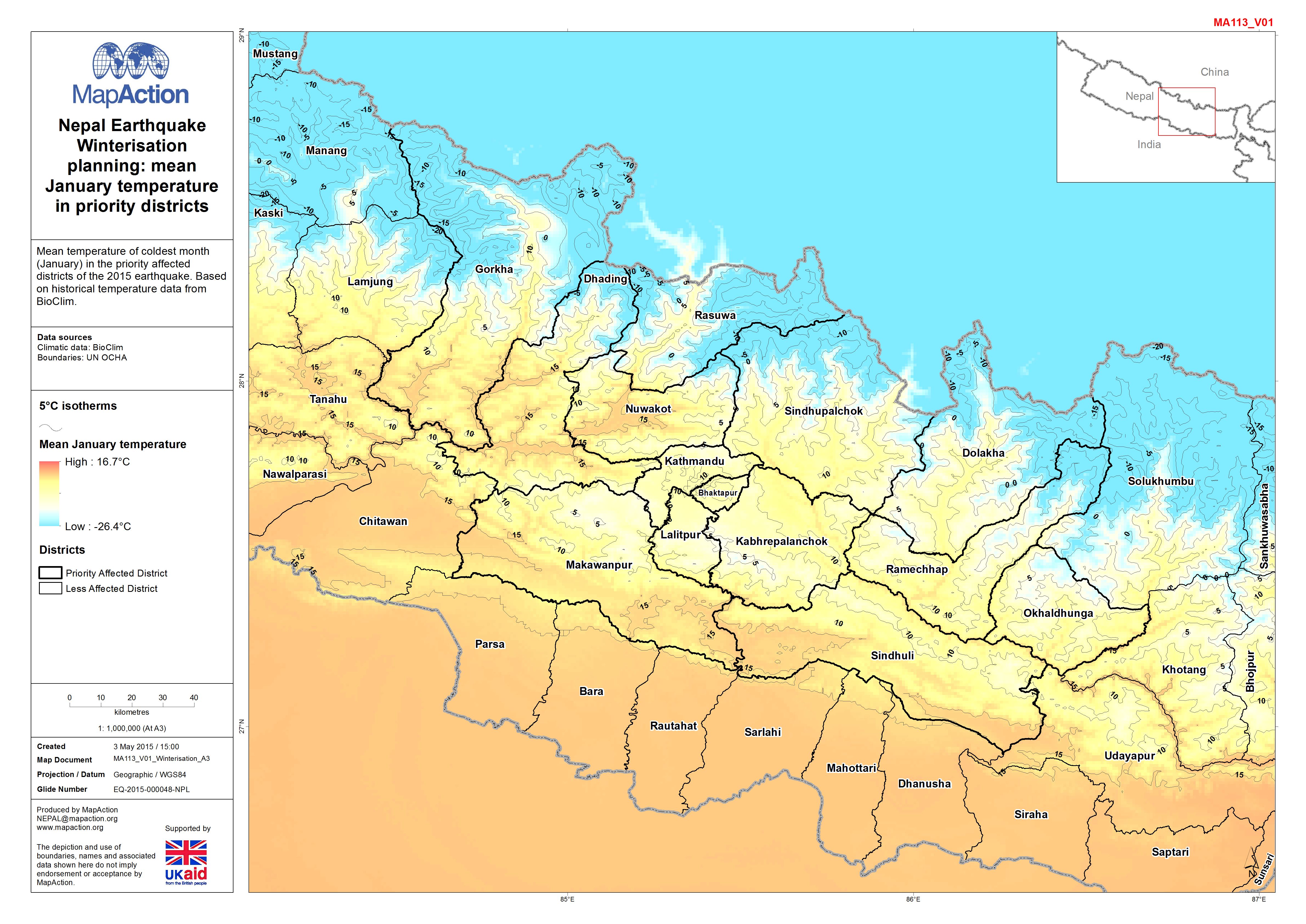
 Nepal earthquake - Winterisation planning - mean January temperatures in priority districts
Maps to assist in the planning for humanitarian responses that are expected to continue into the winter season. They help responders to plan for humanitarian responses under cold weather conditions, by identifying communities facilitate timely response to earthquake disasters, focusing on anticipated hazards and impacts of this type of event. Maps may be produced to coordinate urban search and rescue, to visualise access to affected areas, to analyse patterns of structural damage and assessed needs, and to plan a humanitarian response across multiple sectors.
Strategic or operational?
Both.
Basemap, baseline or situational?
Situational.
When might it be produced?
Disasters or complex emergencies may occur during wintertime, or humanitarian needs may be anticipated to continue into the cold season. Maps to assist in ‘winterisation’ may therefore be requested at an early stage of an emergency, well ahead of the onset of cold weather.
Intended audience
Humanitarian responders, particularly emergency shelter and camp coordination and management actors.
Influence on humanitarian decisions
When population displacement has occurred or is threatened, the provision of climate-appropriate assistance is essential to avoid harm to vulnerable populations. It is particularly important to provide winterised shelter and also to reliably anticipate and plan for logistical access for relief assistance during winter months. Maps are essential for the spatial planning of winter relief operations.
Methods
- If no historical temperature data is available, use elevation data as a proxy and annotate estimated winter low temperatures based on the lapse rate (approximately 6 degrees C per 1,000 metres elevation).
- Overlay locations of vulnerable people, e.g. IDP camps, to highlight where winterisation programming is most likely to be a priority.
Data
- Topographic data with vectorised elevation to allow upland areas to be symbolised appropriately.
- If available, historical average winter low temperature data and, if relevant, rainfall/snowfall data. This may be available from national or regional meteorological agencies.
- Any data available on access to key routes during winter conditions.