 Caribbean - Isaac - Wind speed probabilities at 34, 50 and 64 knots (as at 11 Sept 18)
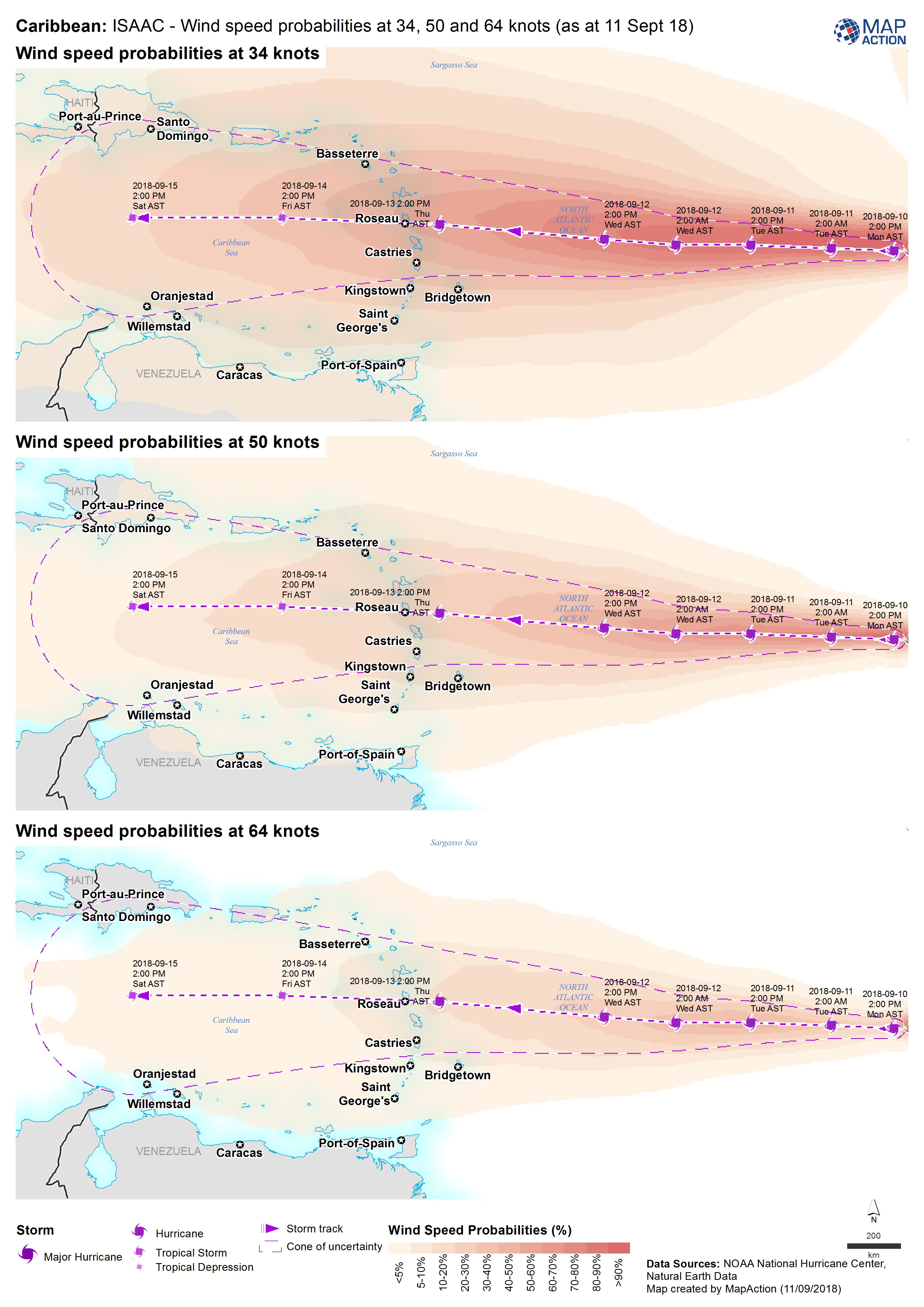
The wind speed probability maps is complimentary to any storm track map that may be produced. It provides an indication of expected wind speeds along the path of the storm.
Strategic or operational?
Both.
Basemap, baseline or situational?
Situational.
When might it be produced?
Before the cyclone or storm has made landfall. It will help with the planning of a response as it will indicate where the strongest winds are expected and therefore the areas that might be more prone to damage.
Intended audience
All responders, but particularly those operating across the wider affected area, and including actors working on assessment processes and response planning and coordination.
Influence on humanitarian decisions
Storm events may have multiple aspects of damage and impact, including the direct effects of high winds, rainfall and consequent flooding, storm surges and coastal flooding.
Methods
Include the actual and forecasted storm track. The data often comes at three wind speeds and it is very easy to produce a map with a map frame for each of the wind speeds. Take care when labelling and annotating maps to distinguish between forecast, modelled and actual observations. Make sure to avoid confusion over both the date and time the forecast was issued, and the date and time to which the forecast applies.
Data
The following data types may be available from national or regional meteorological agencies:
- Storm tracks: forecast and actual
- Wind speed probabilities