 Central Sulawesi Estimated Tsunami Inundation and Modelled Liquefaction Hazard
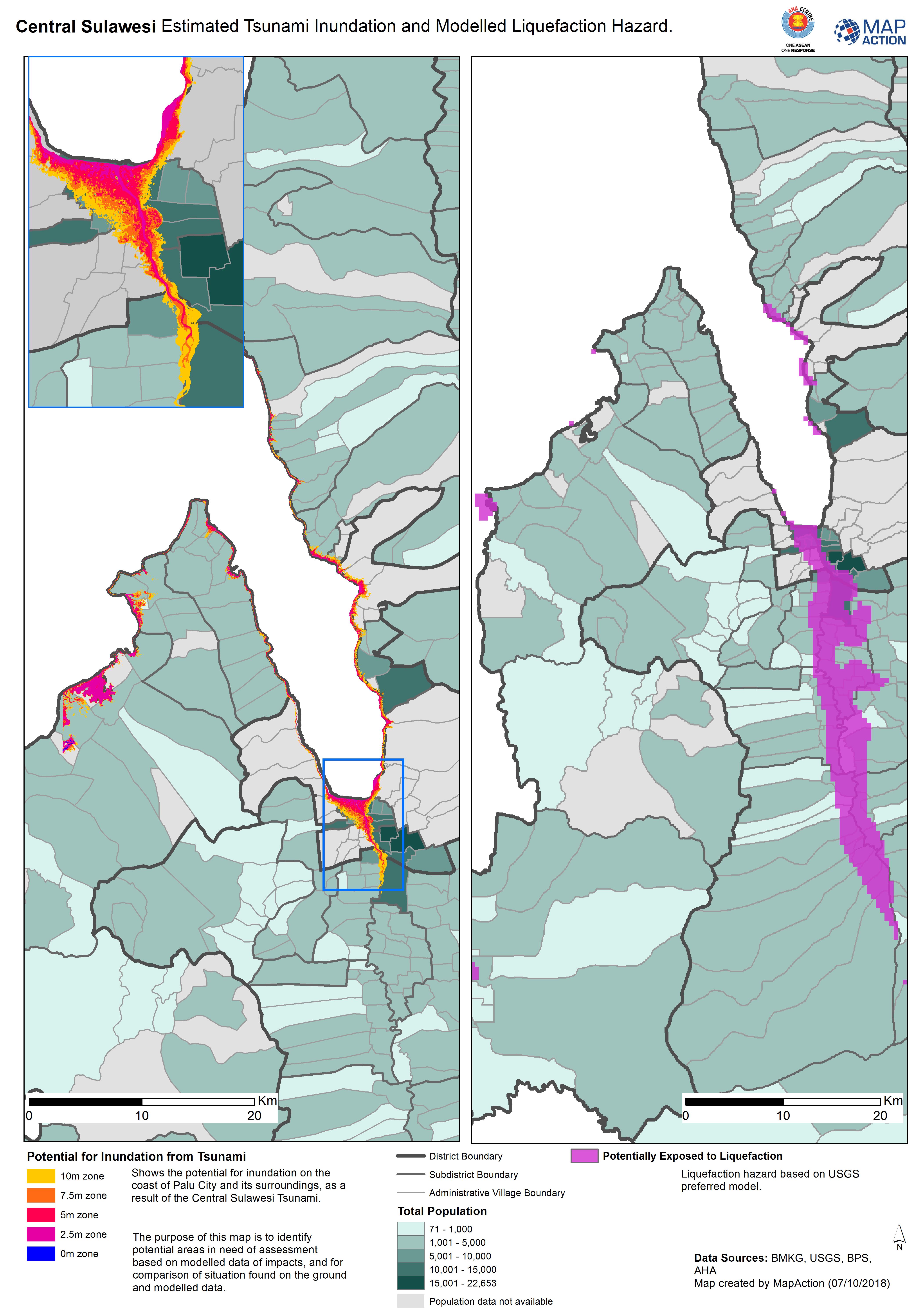
Maps produced during a humanitarian response to destructive tsunami, usually arising from offshore earthquakes. This section describes mapping the specific impacts of the tsunami, rather than the trigger earthquake, which may itself have direct effects on land.
Strategic or operational?
Both
Basemap, baseline or situational?
Situational.
When might it be produced?
Usually early on in the response, to map impact information that can then highlight priorities for a life-saving response, and to focus in-field damage and needs assessment on areas most likely to be affected.
Intended audience
All responders, but particularly those operating across the wider affected area, including actors working on assessment processes and response planning and coordination, and on logistics planning.
Influence on humanitarian decisions
Tsunamis cause humanitarian impacts through their direct effects (coastal flooding with little or no warning), and indirectly they may hamper a response to the wider impacts of an earthquake, for example by impeding access. Any impact close to the coast is likely to be devastating, and create multi-faceted needs in densely populated coastal zones. Where primary transport links have been severed, e.g. coastal roads, mapping is likely to be an important tool for planning and coordinating logistical access to affected communities.
Methods
While the extent of inundation will vary along a coast hit by a tsunami, it can be assumed that communities close to the coast, even if not flooded, will see affected people seeking refuge. Therefore, mapping of communities, with population figures of those living within the coastal zone will be valuable for needs assessment.
Data
The following data types may be available from national or regional meteorological agencies:
- Modelled data on tsunami propagation, if available. However, be aware that local variations in coastal morphology will greatly vary the wave impact location by location.
- Settlement data for coastal districts.
- Road data, including if possible locations of bridges over coastal inlets.