 The Philippines - Areas at potential risk of 2m storm surge based on historical data
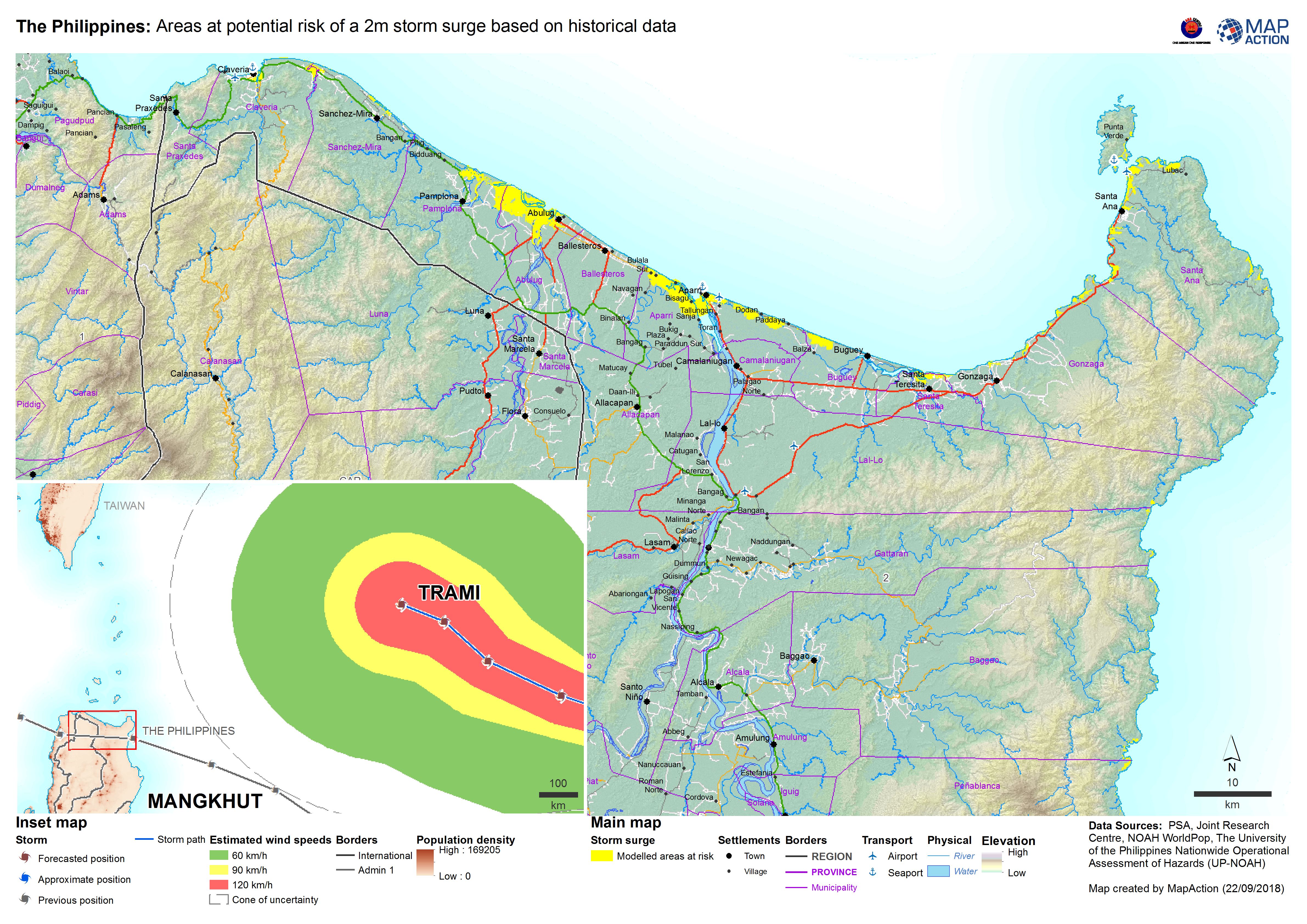
In the event of a cyclone or storm there is a threat of a storm surge and coastal flooding along coastal areas. It is affected my a number of factors including the depth (shallowness) of the water, land masses funnelling the water through a smaller gap and the tides. A storm surge on a high tide will have a higher impact.
Strategic or operational?
Both.
Basemap, baseline or situational?
Situational.
When might it be produced?
Modelling may have already been done as a preparedness activity by the national meteorological service and if available the data can be used in conjunction with the storm track as soon as possible.
Intended audience
All responders, but particularly those operating across the wider affected area, and including actors working on assessment processes and response planning and coordination.
Influence on humanitarian decisions
With 40% of the global population living in coastal regions, storm surges can have a high impact on the population and properties. The map will help the decision makers understand what populations are exposed to the risk of a storm surge and take the necessary actions such as evacuating the population.
Methods
The storm surge data before the event will be modelled and will be indicative i.e. a surge might not occur at that specific location for that event. Post event there will be either recorded data from measuring stations, field assessments or remote sensing.
In the case of modelled data, a series of maps may need to be produced based on the different modelled storm surge heights. For post disaster maps, tt will be possible to indicate which areas have been affected from post disaster analysis. As with many of the storm related maps using the storm track is a useful indicator.
Data
The following data types may be available from national or regional meteorological agencies:
- Storm tracks: forecast and actual
- Storm surge modelling
- Storm surge observations
- Storm surge remote sensing observations