 Central Sulawesi Estimated tsunami inundation and modelled liquefaction hazard
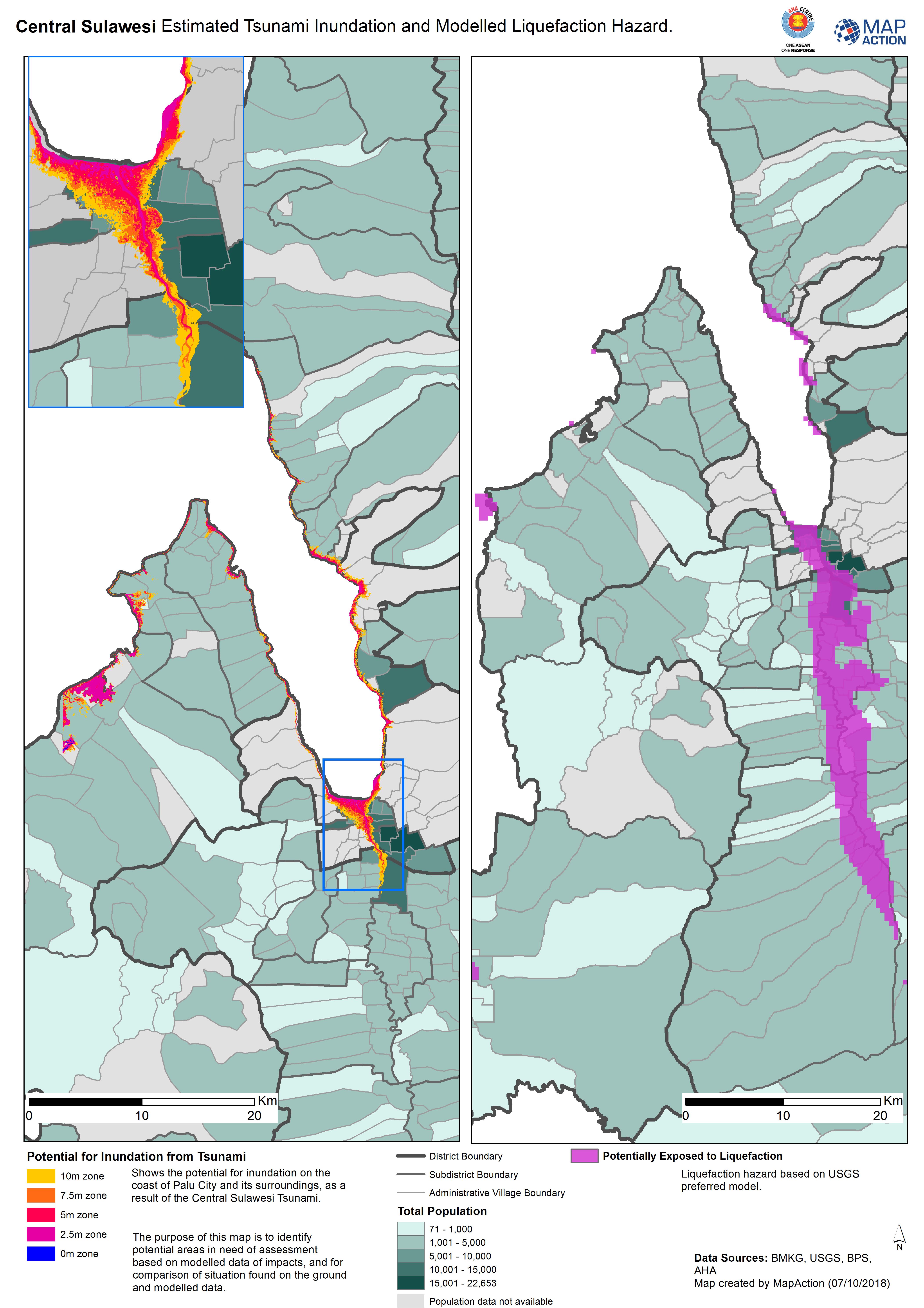
Liquefaction will typically (but not exclusively) occur as a result of an earthquake and can cause significant destruction. Maps on liquefaction may show either areas at risk to it through complex modelling or post event areas and the damage caused by liquefaction.
Strategic or operational?
Both
Basemap, baseline or situational?
Baseline and situational.
When might it be produced?
Liquefaction modelling will occur before the event as a preparedness activity by a government, scientific or engineering organisation. Post event, mapping may happen as a result of field assessments or remote sensing analysis.
Intended audience
Anyone involved with planning will be interested in modelling maps and those involved with response will be interested in post disaster mapping.
Influence on humanitarian decisions
Modelled maps will be used by planners and officials to understand the areas and populations that may be exposed and prone to liquefaction. If in the event of liquefaction responders, particularly the urban search and rescue teams, will be wanting to understand where liquefaction has occurred so that they can facilitate any rescues.
Methods
liquefaction modelling is a complex methodology and will required a range of datasets including rock and soil type, hydrology, buildings and seismological. Post disaster mapping should show the extent of the liquefaction, any damage to buildings and general infrastructure and also the population that has been affected. Satellite and aerial photography can be used to identify those areas, as well as field assessments.
Data
- Modelled liquefaction exposure
- Pre and post disaster imagery to compare the areas before and after
- Building and landuse
- Population
- Infrastructure