 Sierra Leone Emergency - Landslide & Floods as at 25 August 2017
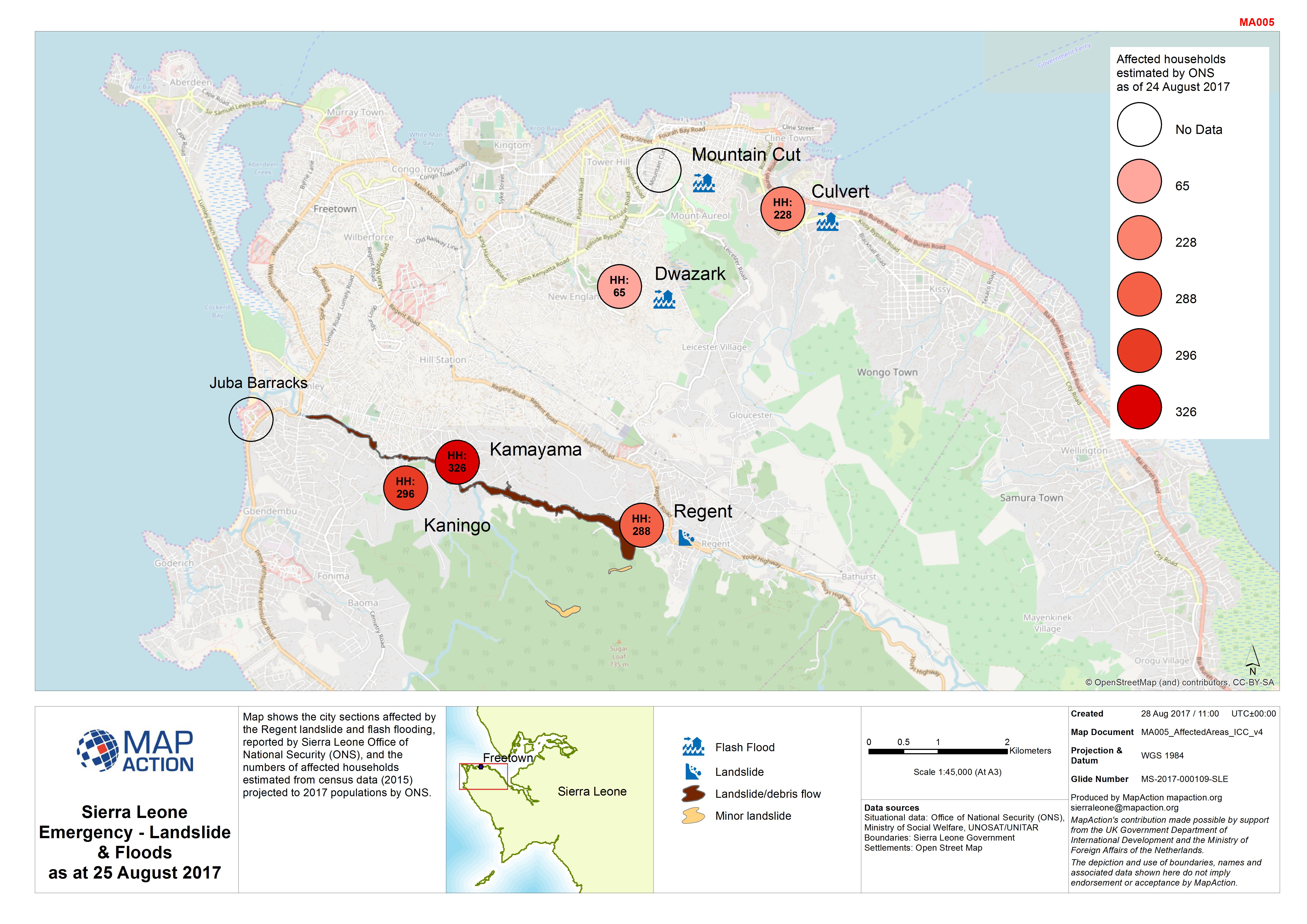
These are maps depicting the hazards and impacts of landslides or other mass movements such as snow avalanches.
Strategic or operational?
Usually operational.
Basemap, baseline or situational?
Situational.
When might it be produced?
When landslides pose the main or a secondary humanitarian hazard, particularly in association with earthquakes or storm events (particularly after very heavy rainfall). Maps may be produced to identify areas vulnerable to landslides in order to identify at risk communities, or to prioritise on-the-ground or aerial damage assessments. Landslides may also be mapped to identify barriers to access to disaster-affected areas.
Intended audience
All responders, but particularly those working on assessment processes and response planning and coordination. Also, when relevant, logistics planning actors.
Influence on humanitarian decisions
Landslides can have a direct impact on communities, and can also block access to large areas of land. Maps showing known/confirmed landslides may be valuable as proxy indicators of likely damage and needs after an earthquake or storm event. Predictive mapping should be used only with caution.
Methods
- Predictive mapping of landslides may use spatial variables such as earthquake shake intensity, slope angles and cumulative rainfall statistics.
- Data on actual landslides can be reliably obtained from ground level, aerial or satellite remote sensing. If these are included on maps, then any areas not analysed should be clearly identified to avoid “no data = no impact” confusions.
Data
- In the case of earthquakes: modelled shake intensity (as polygons).
- In the case of storms events: cumulative rainfall data – typically from national or regional meteorological agencies.
- Terrain data allowing analysis of average slope angles.
- Reported landslide locations (points or polygons) derived from ground survey, aerial or satellite imagery.