 Malawi - flood event - flood modelling - Southern districts
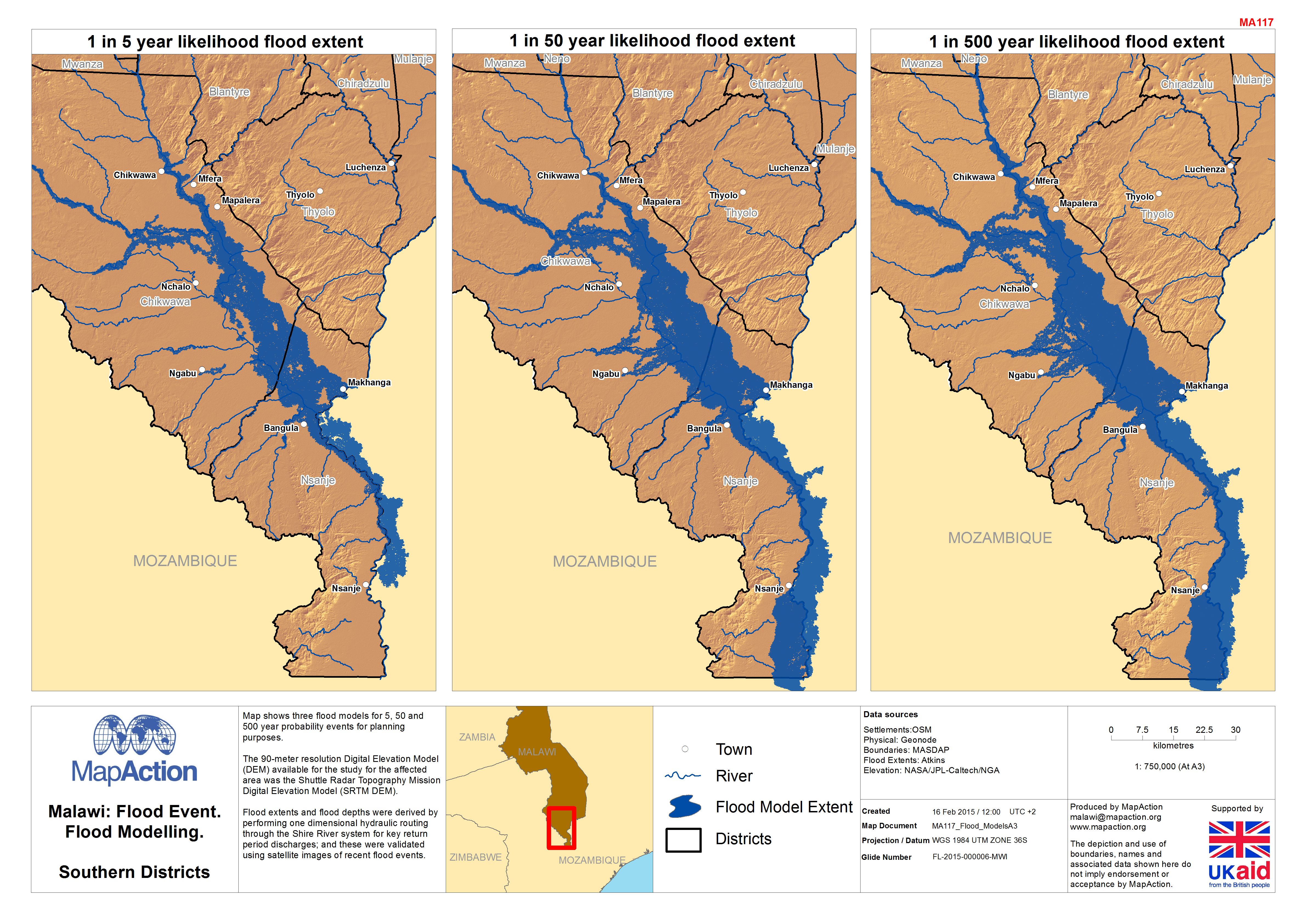
Flood forecasting and modelling maps aim to show where there is a risk of flooding in an area based using precipitation, streamflow data and a range of other criteria. The time range and accuracy varies according to the models. You will see flood modelling predicting the flood extents as rain is falling or based on probability i.e. a 100 year flood event.
Strategic or operational?
Both.
Basemap, baseline or situational?
Baseline.
When might it be produced?
The maps that look at probability will be part of preparedness work done by the science and engineering communities as part of preparedness and insurance work. The short term forecasting will occur as the event unfolds.
Intended audience
All responders, but particularly those operating across the wider affected area, and including those working on assessment processes and response planning and coordination.
Influence on humanitarian decisions
For governments planning responses the maps will be indicative of the risk and exposure to floods in specific areas allowing them to plan construction work to mitigate and also to give them an indication how much of a population might need evacuting or some form of assistance in the event of a flood.
Methods
The actual modelling of a flood is complex and requires a range of data which is unlikely to be found in the middle of a response. Beacuase of this it is better to look towards those organisations that create the models. In a response, or part of preparedness work additional datasets, such as population and infrastructure could be included to show who and what could be affected by a flood.
Data
- Predicted flood events