 Mozambique - Cyclone Idai - Flood extent (as of 31st March 2019) and baseline population
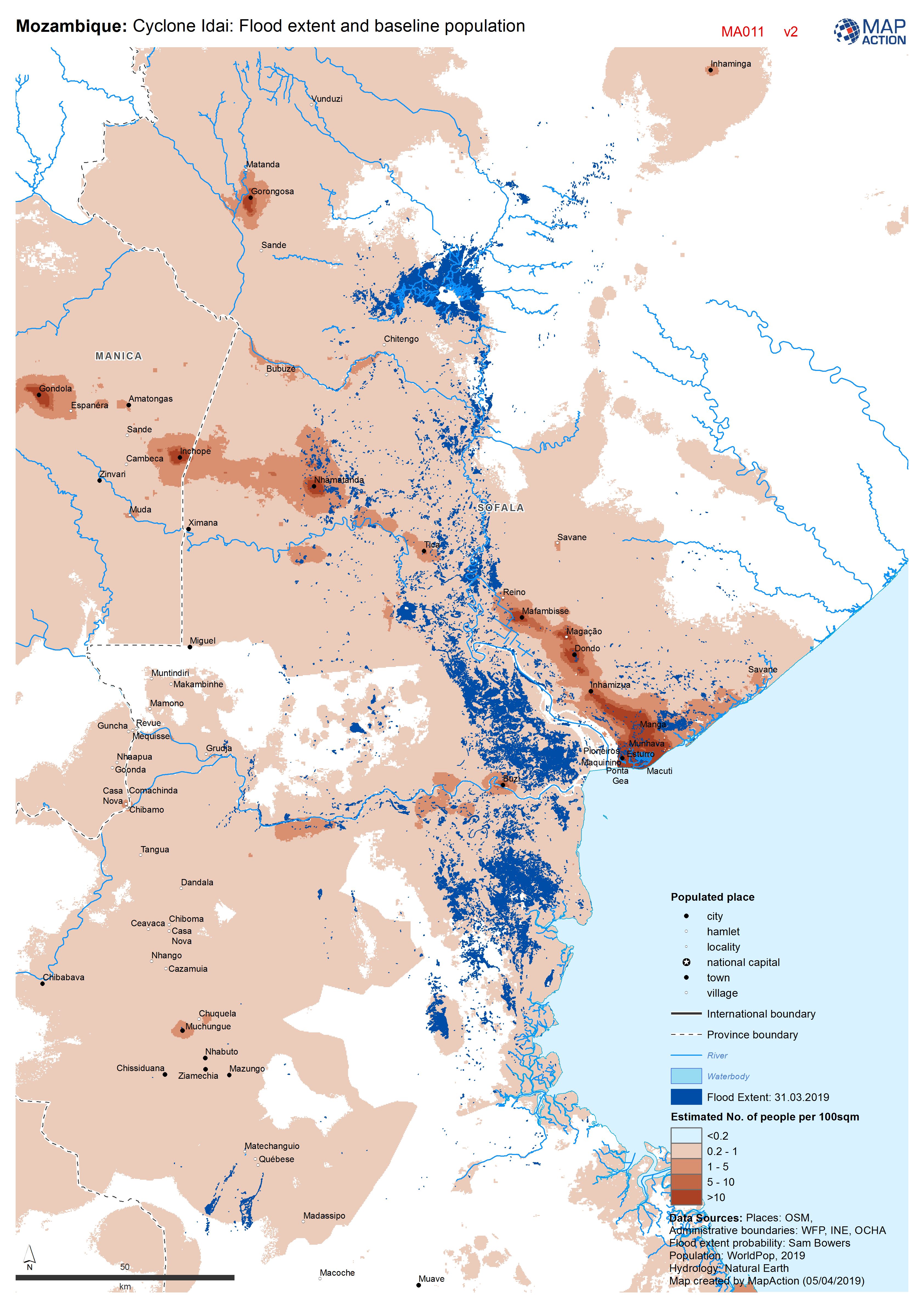
Maps produced during a humanitarian response to floods (including those caused by tropical storm events), focusing on the hazards and impacts that typically characterise such emergencies. Floods may affect wide areas, limiting access to communities and triggering large-scale population displacement. Maps in association with satellite imaging can visualise the extent of flooding and analyse the likely impact on communities. They are also used to plan needs assessments and a humanitarian response across multiple sectors.
Strategic or operational?
Both.
Basemap, baseline or situational?
Situational.
When might it be produced?
Usually early on in the response, to provide initial predictive or actual impact information that can then highlight priority areas for a life-saving response, and to focus in-field damage and needs assessment on areas most likely to be affected.
Intended audience
All responders, but particularly those operating across the wider affected area, and including those working on assessment processes and response planning and coordination.
Influence on humanitarian decisions
Floods may be localised, but can also cover wide areas and render communities inaccessible. Initial response decisions including resource mobilisation should be taken in light of what can be inferred from remote sensing of the extent of the floods. However, such predictors should be used with caution, recognising that the reach of floods may continue to change rapidly, and should be triangulated as soon as possible with mapping of primary data such as field assessment reports.
Methods
- Keep in mind that floodwater is not static and that maps should therefore be updated regularly.
- Attempts to model predicted flooding using, for example, elevation contours, are unlikely to be reliable and should be avoided unless there is a proven methodology.
- Prolonged water logging of ground, which may not show up as standing water on imagery, can have a severe humanitarian impact – so reliance on remote sensing alone should be avoided. Large 3W datasets can be mapped using Data Driven Pages (ESRI) or QGIS Atlas.
Data
- Remote sensed data from satellite imaging data providers such as UNOSAT. This should be requested as pre-analysed vector data (e.g. ‘flood polygons’) rather than raw imagery. Caution must however be used with such data, due to the unknown effectiveness of analysis.
- Any available data from previous flood events may be helpful in identifying areas prone to flooding, although obviously such data should be interpreted with caution in the current situation.