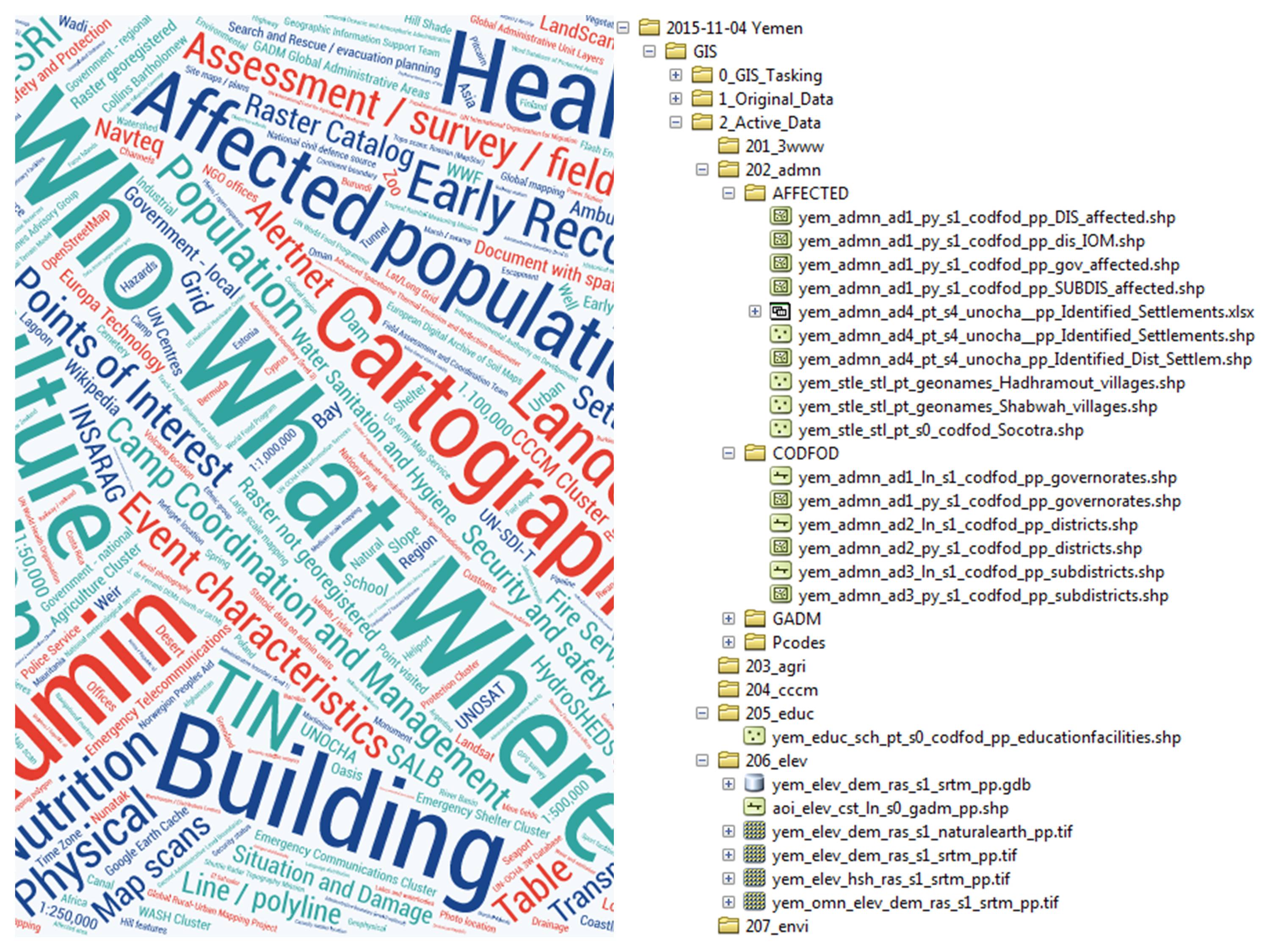
 It is import to have some sort of naming convention so that data can be easily managed and understood by the user. MapAction has developed a data naming convention that is split into a number of clauses. These clauses capture a large number of important metadata details without the need for a full metadata file.
The MapAction data naming convention looks like this:
It is import to have some sort of naming convention so that data can be easily managed and understood by the user. MapAction has developed a data naming convention that is split into a number of clauses. These clauses capture a large number of important metadata details without the need for a full metadata file.
The MapAction data naming convention looks like this:
- geoextent_datacategory_datatheme_datatype_scale_source_permission_freetext
- e.g.
- lbr_admn_ad1_py_s0_gaul_pp_counties
- phl_tran_rds_ln_s0_openstreetmap_pp_roads
- hti_evt_epi_pt_s0_usgs_pp_epicentre
- e.g.
The purpose of each clause is as follows:
- geoextent - this describes the area that the data covers. Typically this is at country level and the ISO3 country codes are used in the clause.
- datacategory - this provides a broad description of the content, e.g. health data, population data, transport data. It uses a four letter description.
- datatheme - this a more detailed description of the content based on datacategory, e.g. hospitals, number of IDPs, road type data. It uses a three letter description in the clause.
- datatype - this is the geometric type of the spatial component of the layer, e.g a point, line, polygon, table, etc. It uses a two/three letter description in the clause.
- scale - this represents the order of magnitude of the scale at which it is appropriate to display the dataset. It does not represent the survey scale, resolution or other concepts of scale. This is intended to distinguish multiple datasets that are useful at different scales. It uses a two letter description in the clause.
- source - describes the original source of the dataset. It can use as many letters as necessary in the clause.
- permission - this describes both the permissions for redistributing data, and for distributing maps derived from the data. It can help with assigning a licence. It uses a two letter description in the clause.
- freetext - this provides free text to describe in greater detail, if needed, what the data is, e.g. the administration level name (states, counties, districts, etc). It can use as many letters as necessary in the clause.
This is just one method of naming data and can use this or create one that suits the needs of your project or organisation.