 Atlantic Ocean - Actual and forecasted storm tracks (as at 12 Sept 2018 2300 AST)
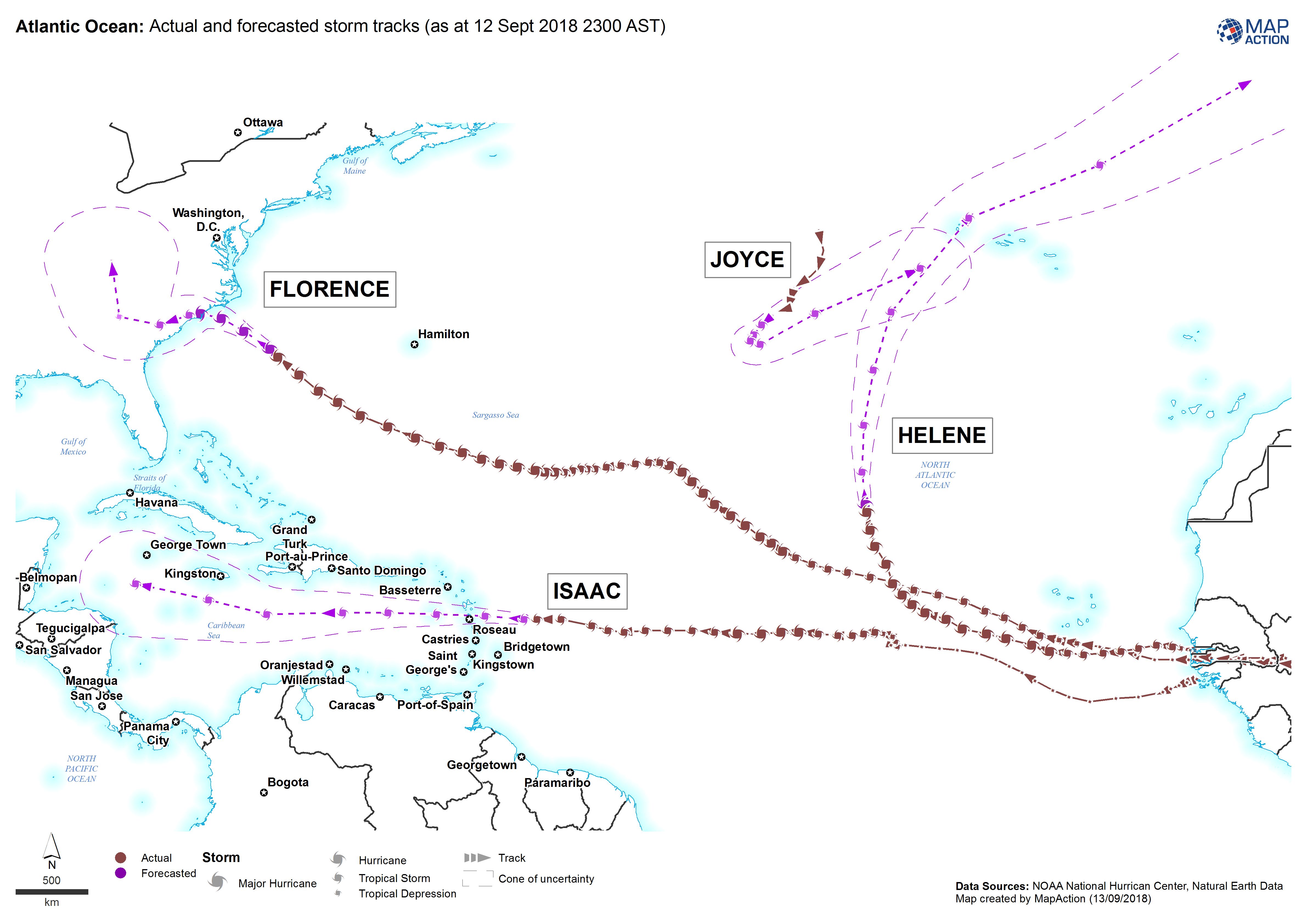
Maps produced during a humanitarian response to storm events – typically tropical storms – focusing on the hazards and impacts that typically characterise such emergencies.
Strategic or operational?
Both.
Basemap, baseline or situational?
Situational.
When might it be produced?
Usually early on in the response, to provide initial predictive or actual impact information that can then highlight priorities for life-saving responses, and focus in-field damage and needs assessment on areas most likely to be affected.
Intended audience
All responders, but particularly those operating across the wider affected area, and including actors working on assessment processes and response planning and coordination.
Influence on humanitarian decisions
Storm events may have multiple aspects of damage and impact, including the direct effects of high winds, rainfall and consequent flooding, storm surges and coastal flooding. Storms often affect large areas and compromise telecommunications. Therefore, predictors of physical damage and impact may be important for both the initial response and assessment planning. However, such predictors should be used with caution and should be triangulated as soon as possible with mapping of primary data such as field assessment reports.
Methods
Take care when labelling and annotating maps to distinguish between forecast, modelled and actual observations. Make sure to avoid confusion over both the date and time the forecast was issued, and the date and time to which the forecast applies. Caution should also be taken when showing the cone of uncertainty - this where the storm could go and not necessarily the whole area that will be affected or damaged.
Data
The following data types may be available from national or regional meteorological agencies:
- Storm tracks: forecast and actual
- Storm surge data for selected coastal locations.
- Accumulated rainfall for selected locations, or ideally as polygons